Sunday I drove historic Route 66 into Eastern California to
sample the Cambrian Middle Member of the Wood Canyon Formation (MMWCF) in the
Southern Marble Mountains. This would be the hottest and one of my more remote sample
locations. The Southern Marble Mountains are located near the settlement of
Cadiz and just south of historic Route 66 through the Mohave Desert. This was
one of my longest driving days at 366 miles or about 7.5 hours.

While the range is somewhat unimpressive, reaching perhaps
300m above the surrounding alluvial plane, the sheer “desertiness” of the areas
was quite spectacular. Here’s a view from near the top of the mountain.
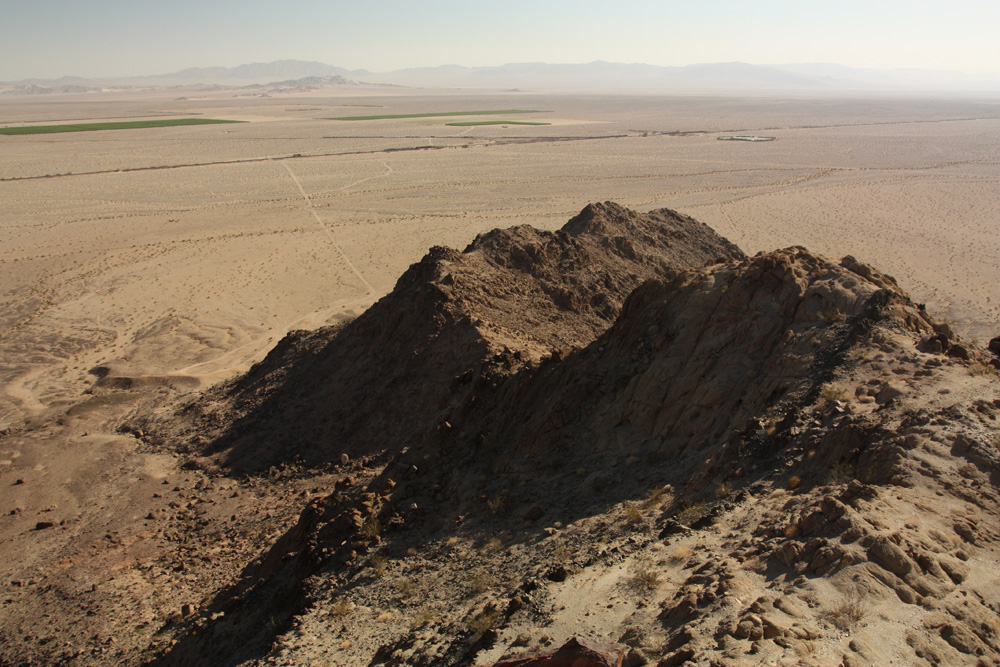
The green patches in the distance are irrigated fields managed by Cadiz Inc., the only local employer. The tan areas are amalgamated alluvial fans which mantle the
mountains.
The rocks were very well exposed, but unfortunately I had to
climb to the top of the mountains to get a good look. Normally I wouldn’t shy
away from a bit of climbing but it was 4:00 and 43 C when I left camp. Here’s
the unconformity between the underlying Proterozoic porphyritic granite and the
basal sandstones of the MMWCF.

Very nice desert varnish on the rocks makes it easy to see
variations in bedding and grain size. Here’s a shot of some very nice cross
lamination.

I random camped on BLM land at the foot of the mountain.
This would be a terrible place to camp if it rained. Thankfully there wasn’t a
cloud in the sky all day.

They always say that deserts get cold at night. This has not
been my personal experience. It was insufferably hot until about 1:30 AM and
then just miserable until around 5:00. I did not sleep well and decided that in
hot weather a roof top tent would be better than being in the vehicle. I wonder
if I could convince Trish…..
No comments:
Post a Comment